Backcountry Camping: Bugaboos Provincial Park, Golden, BC
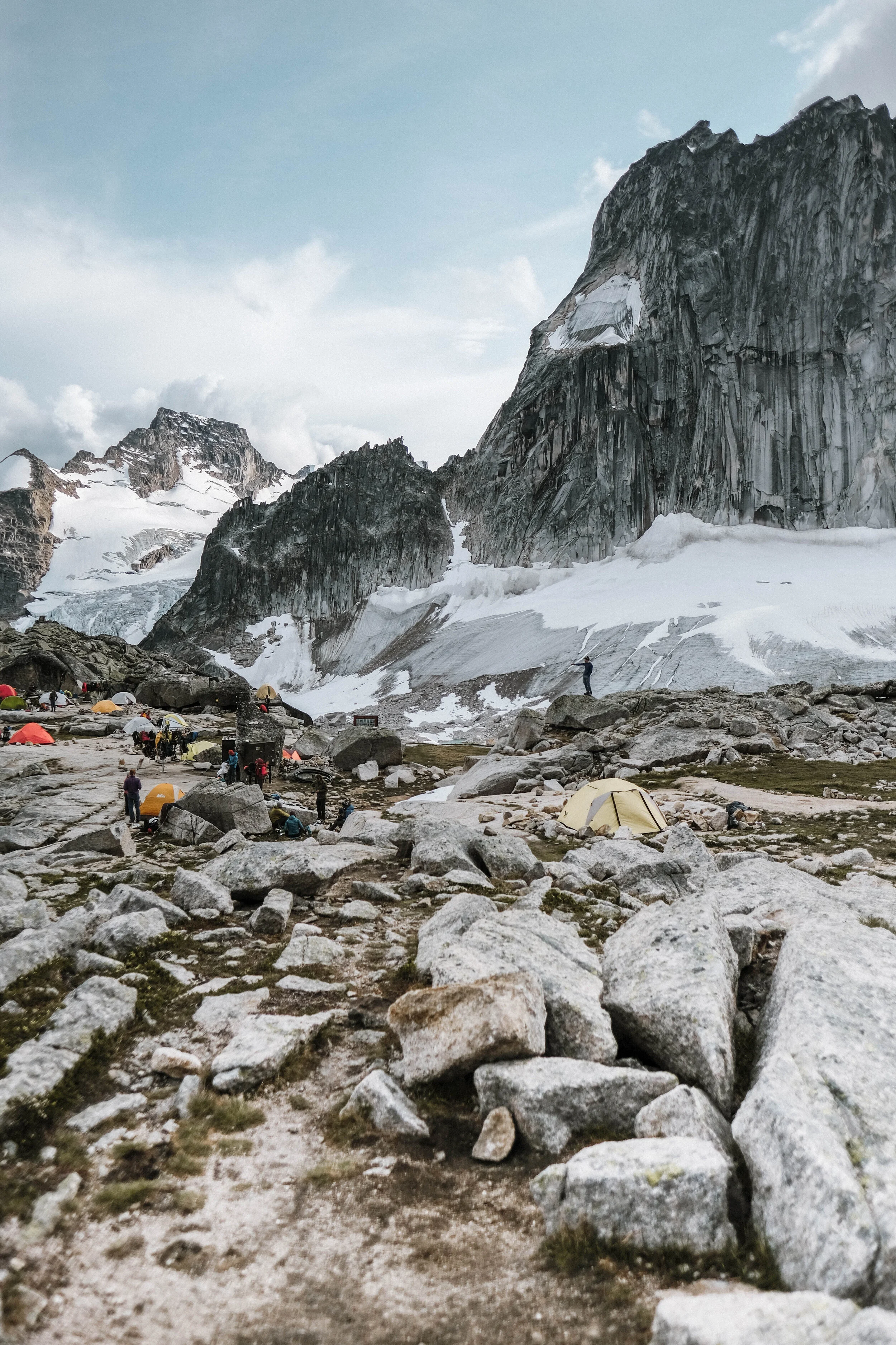
Applebee Dome Campground, Golden BC, Canada
Backcountry camping -- check! My very first time backcountry camping was at the Bugaboos Provincial Park near Golden, British Columbia, Canada. This park is known for its alpine conditions and challenging spires that climbers from around the world come to conquer. I am nowhere near being considered a climber, but after reading about this hike and Provincial Park in an Epic Hikes book, and seeing tons of Instagram posts for half a year, I was adamant on coming here for myself to see the epic views the Bugaboos had to offer.
My partner and I started our journey by driving from Golden, British Columbia towards Brisco Road off of Highway 95 just after sunrise. After about an hour on the highway, there was a rather small sign indicating the entrance to Brisco Road and the Bugaboos Provincial Park. There is just one route to access the park from this location and it consists of a 50km, rather bumpy, gravel road. We were able to trek along this road rather slowly with our 2WD car. If you are plan on visiting the park, ensure you account about an hour of travel time along this road.
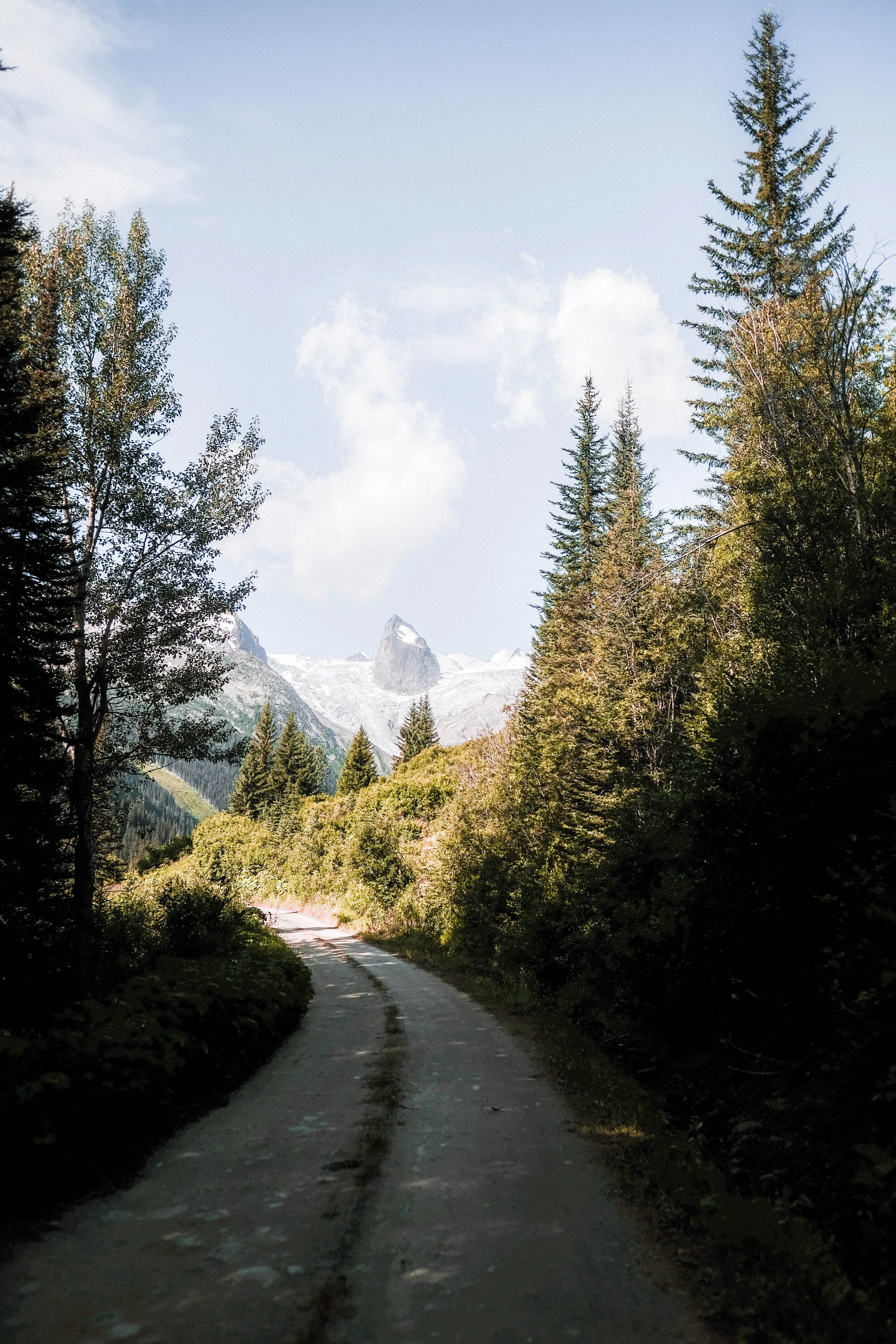
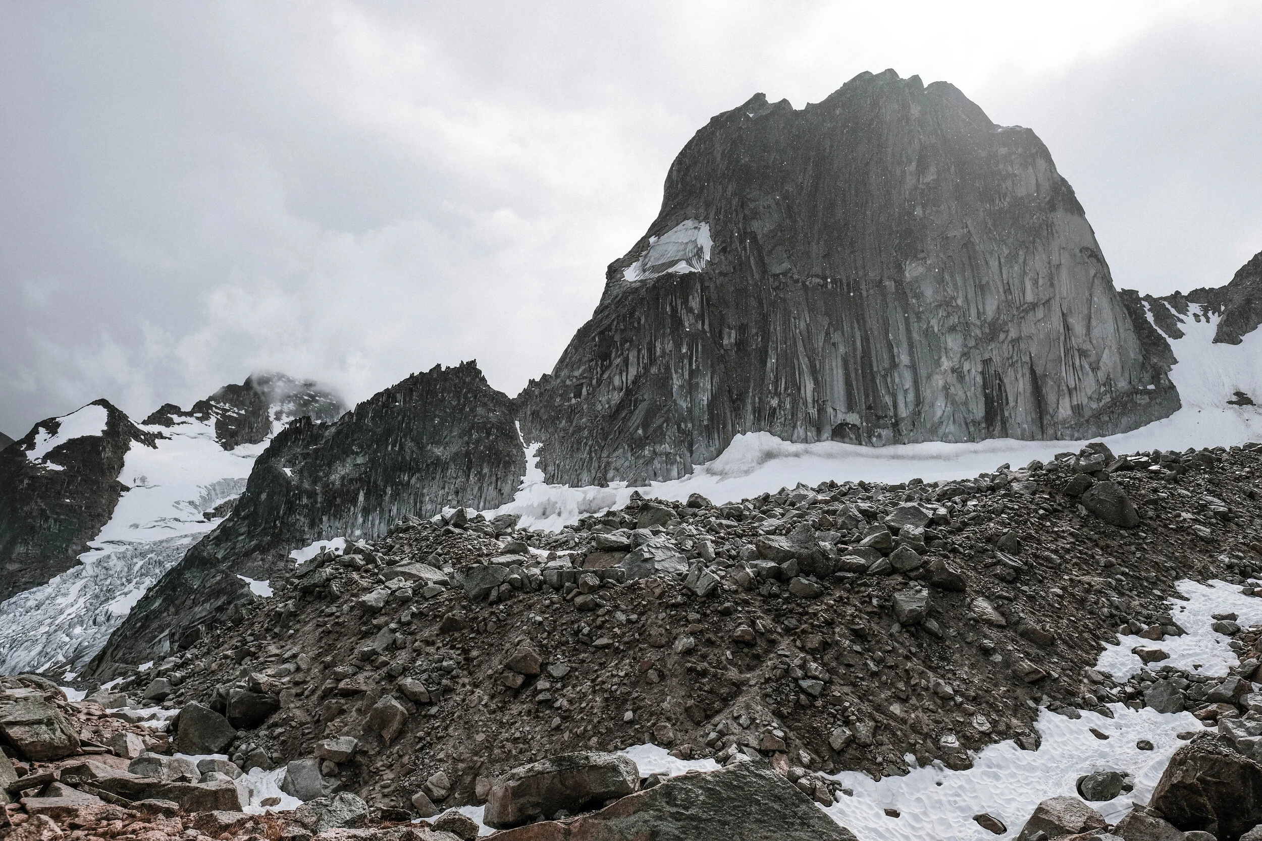
As we approach the last remaining kilometres of the treacherous gravel road, we were welcomed with our very first sight of the spires. Just straight ahead of the valleys of pine trees, the view of the Hound's Tooth Spire aligned directly ahead of us with Bugaboo Glacier wrapped around this granite peak. By that time, we knew the trailhead was just ahead of us.
First Sight of Hounds’s Tooth Spire
Duration: 60 minutes from Brisco Road | Distance: 20 km
We arrived at the parking lot at a quarter past 10 in the morning to find the main parking lot already full of cars (obviously). We ended up parking alongside the gravel road just a few metres from the main parking lot. We spent the next hour packing our 40 lbs worth of gear and wrapping the base of our vehicle with chicken wire, which was readily available near the trailhead entrance (no need to worry about bringing your own!). So, after about two hours and 45 minutes of driving and preparing, our adventure began!
Prior Preparations - Installing Chicken Wire
Tips:
Chicken wires, posts, and rocks were readily available at the park. **We left the site when the long weekend started, and saw some cars without them. So if you plan to come during the long weekend, perhaps think about getting your own wires.
The hike started off at a steady pace with a slow incline (barely an incline, to be honest). This part of the trail is a well-maintained pathway with a few footbridges that help cross muddy terrain and streams of water from the glaciers. After a good 30 minutes, we reached a point on the trail where we knew for a fact that we were about to experience some significant elevation gain. Straight ahead was another view of the Bugaboo Glaciers and the Hound’s Tooth Spire. The elevation gain was much steeper, but manageable. After a small scramble-type part of the hike, we were back into the dense forest and lost sight of the spires.
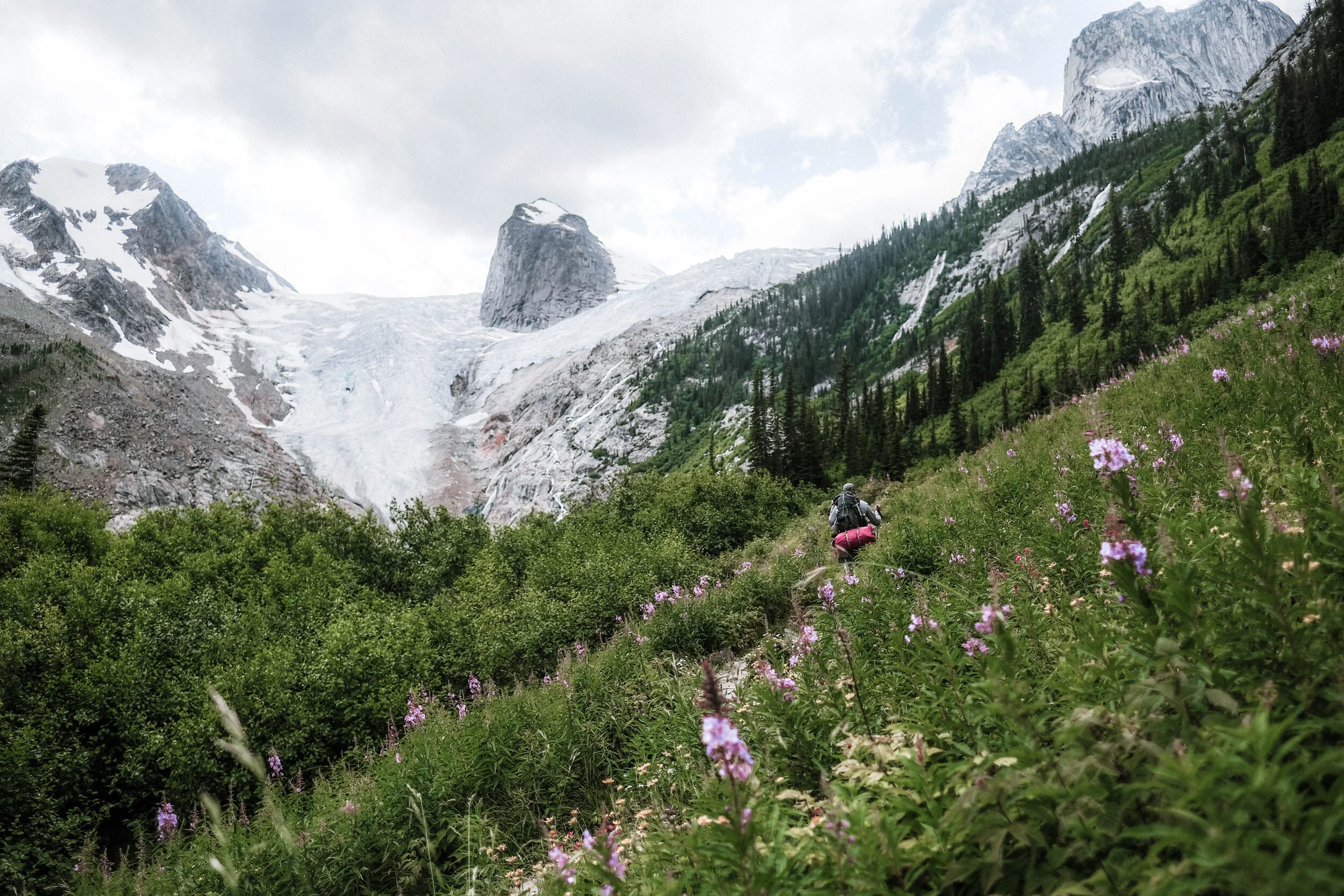
After a little over 2km from the trailhead, the pine trees suddenly disappeared on either side and we were in rolling hills covered with violet wildflowers, and the Bugaboos Glacier, Hound’s Tooth Spire, and other surrounding spires reappeared again. The view really took us by surprise - we stood absolutely still and did a 360-degree look-around to appreciate the sheer scale of the Bugaboo Glaciers. As we stood in awe, we noticed that there was a loud sound, almost like a helicopter closing in to our location. But we realized it was the sheer sound from the glacier water flowing from the Bugaboo Glacier.
Wild Flower Fields & Bugaboos Glacier
Time Lapse from trailhead: 1.5 hours | Distance: 2 km
After the stretch of the wildflower fields, the real hike starts. The elevation gain was very tough, and the next few kilometres of the trail were filled with a combination of minor switchbacks and steep gravel pathways weaving in and out of the trees. I personally felt gravity weighing down on my pack as the climb became steeper with every step. The temperature was also noticeably dropping as we moved our way up to higher elevation.
After an hour, we reached a steel vertical ladder, with an impeccable view of what was in front of us and a view of the trail we we just trekked through. At this point, I did not bother to pull out my camera as I was just looking forward to getting up the Conrad Kain Hut.
After climbing the ladder, we were welcome with a series of narrow, elevated pathways carved into the larger cliff. With the help of chains anchored into the granite, we scrambled up the steps and boulders until we reached the hut!
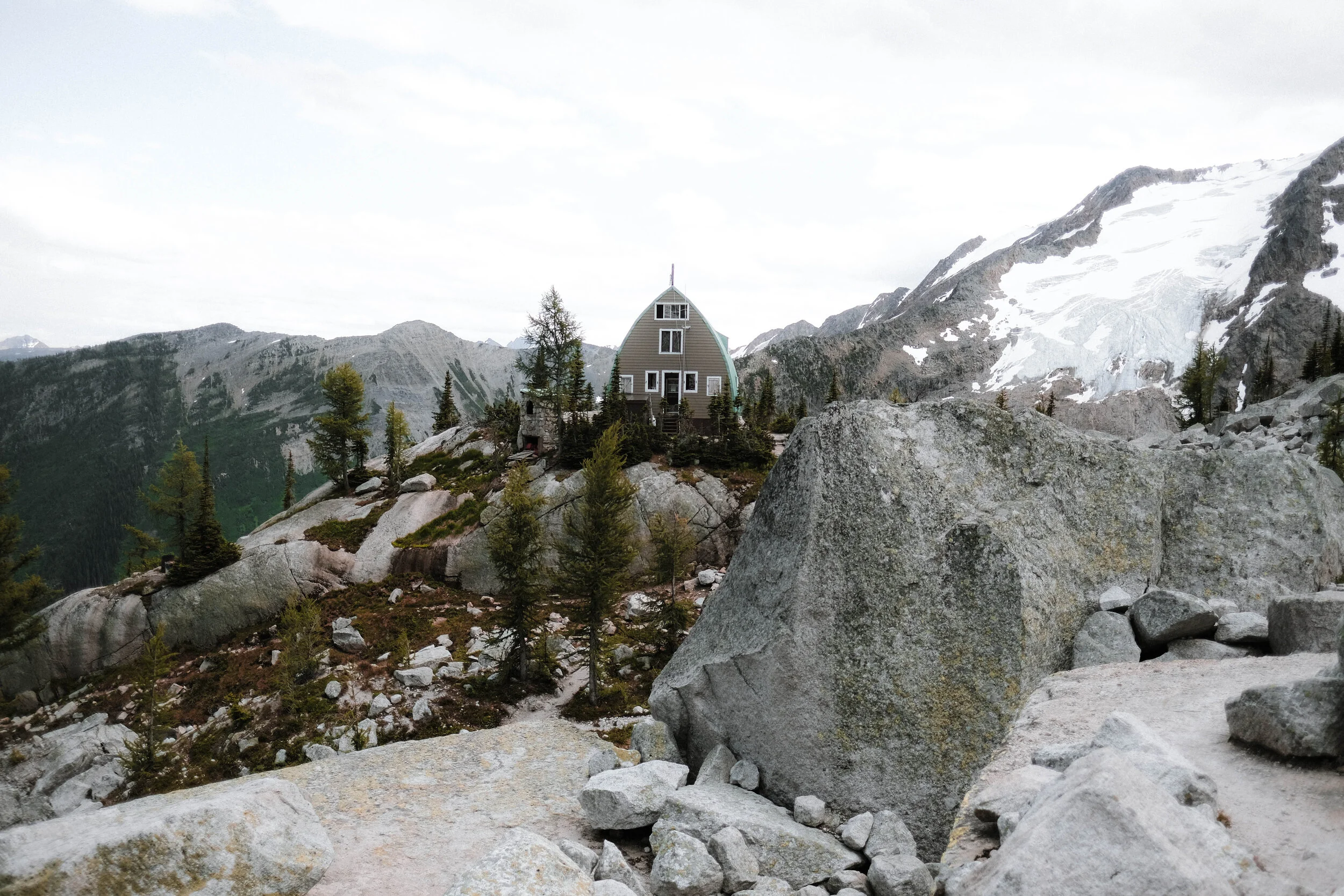
Conrad Kain Hut
Table Lapse from trailhead: 3.5 hours | Distance: 3.5 km
I’ve never been happier to see the green roof of a hut in the middle of nowhere. After 6 months of research and planning our trip, the view of the hut couldn’t have been any better than what I envisioned. The temperature drop became more apparent as we slowed down and rested. The wind also began to pick up, and we could see storm clouds slowly approaching our next destination, the Applebee Dome Campgrounds.
Before making our way onto the last leg of the hike to the campground, we took a breather to admire the view of the glacier from the edge of a cliff. This view was almost a dream - we were able to see essentially all of the spires across the horizon. The continuous “helicopter” sound from the water flowing from under the glaciers was crisp and prominent. After this break, we snapped back into the zone and realized that we had not reached our destination, and we were off again.
Last kilometre to Applebee Dome Campground
Time Lapse from trailhead: 5.5 hours | Distance: 5 km
“One more kilometre, just one more kilometre!” This thought was on repeat for the next hour and a bit. It was getting cold, windy, dark (it was approaching 5:00PM) and as a bonus, it started to rain. For this section of the trail, we had to be creative — some steps were apparent, some were not. The higher we went, the more creative we were to scramble our way up.
At this point, the rain was sticking around and we knew we had to push ourselves to get to the campground before we were completely soaked. We kept our heads down and continued up the never ending piles of rubble. Not too long after, we were welcomed by a cluster of other hikers on a ledge sipping hot beverages. The next best sight of the day— we made it.
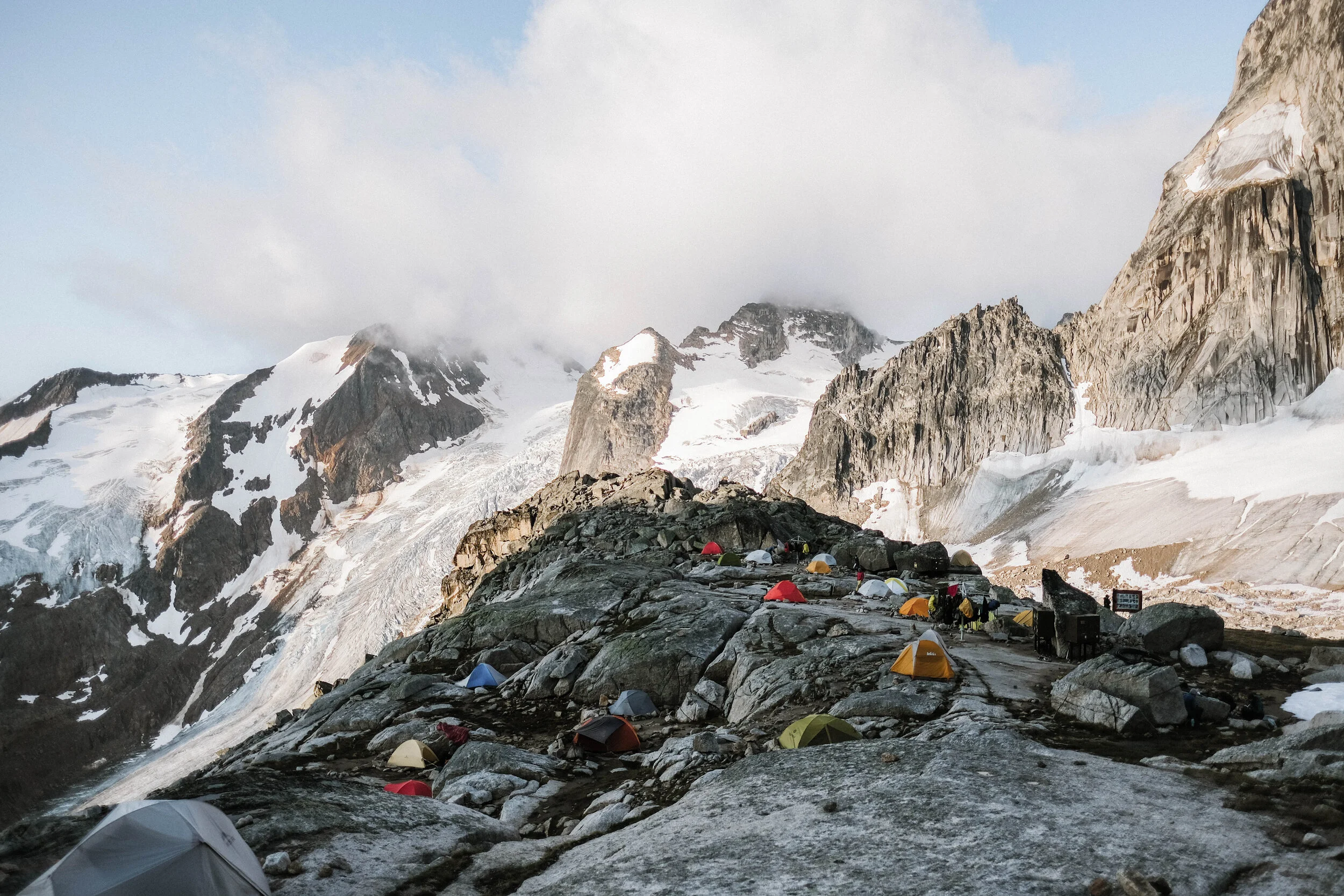
Applebee Dome Campground
Time Lapse from trailhead: 6.5 hours | Distance: 6 km
“We are here.”
What a feeling — it was so pleasant to see other hikers (most of them, if not all, were climbers). It felt like we had arrived home, even if we have never been there before. We spent the next few minutes just scanning the entire campground, observing everyone around us. There were climbers walking around with their gear (perhaps just coming back from climbing the nearby spires), groups of climbers gathering around their tents making supper, and there were others getting ready to call it a day and had already snuggled in their tents.
We spent the next couple of minutes scanning for higher grounds to build our tent. It was 7 degrees Celsius and extremely windy — we had difficulty setting up the tent, but our neighbour was kind enough to lend us a hand. Next up was supper time, and on the menu that night was our very first freeze-dried food — mac n’ cheese by Backpacker’s Pantry. Not going to lie, it was probably the best meal that we had so far on the trip. Afterwards, the storm clouds started rolling in behind the Snow Patch spire and this time it looked like it was going to stay for a long while, so we quickly called it a night.
It thunderstormed the entire night.. I remember the night as a frightening one – I’m usually the type that can handle thunderstorms, but the fact the only thing between us and the storm was just 3mm of our tent material was quite an unsettling feeling. The thundering was loud and we heard it striking nearby spires in the proximity. At one point, I asked my partner if the lightning was going to strike us, and his only word of comfort was (paraphrased, because he was half asleep) “lightning strikes on higher ground, and the spires are higher than where we are”. Enough said, I fell back asleep, not too soundly.
The morning came along and this is the view we were welcomed with. I wanted to stay here forever.
My biggest regret of this trip is allocating just one night at the campground. For those of you who are just visiting, I strongly advise to stay at least two nights – there is so much more to do and see, and it will also give you time to enjoy and rest up before making the journey back down.
We spent the next few hours packing up and completed a few small hikes before heading back down.
Trip Summary
Dates Travelled: Friday, August 1 to Sunday, August 3, 2019
Total Travel Duration: 11am to 6pm (6 hours - includes breaks.. lots of them)
Total Elevation Gain: 911m
Tempeature Range: 25 degrees high / 4 degrees low
Touchpoints: Conrad Kain Hut (3.5km) | Applebee Dome Campground (6km)
Tips & Other Resources
Staying at Conrad Kain Hut: Book at least 6 months prior to planned arrival.
Staying at Applebee Campground: Strongly advise to secure a backcountry camping permit & print booking prior to. This will need to be shown to Park Rangers @ Conrad Kain Hut
Worried about vacancy at Applebee Dome Campground? Generally, there were lots of space for vistors to set up their spots. However, Park Rangers mentioned a permit system might potentially be implemented in several years as the campground is getting more traffic every year. If it eases you, I advise to call Conrad Kain Hut to get a sense of how busy it is a week prior to your trip.
Using social media to help plan: I found Instagram stories with the hashtag or geotag of Bugaboos Provincial Park extremely helpful. I was able to connect with a few people that were visiting the park and campground a few days prior to our arrival and asked them some general questions. I got a great sense of the parking situation, the weather conditions, and crowd at the campground.
Maps: I’m an avid user of the Alltrails App and Google Offline Maps. Download these and you’ll be fine. Also, Google has an entire streetview of the hike from the trailhead to Conrad Kain Hut! Check it out, it is pretty awesome.
Water: There is a water tap for untreated water, which extracts water from a resevoir nearby.
Fin
Feel free to leave any comments/questions down below or say hi!
